PROJECTS

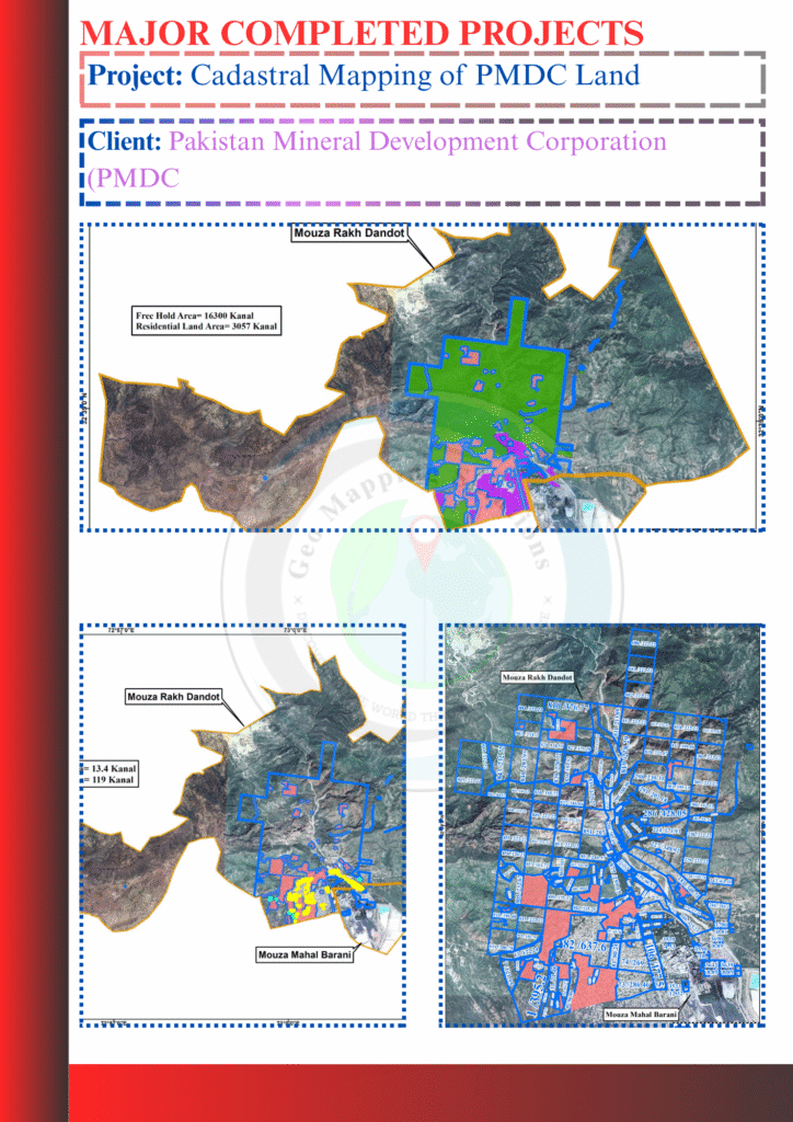
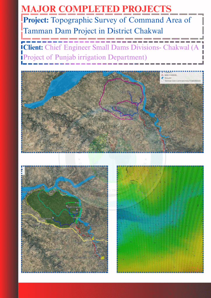
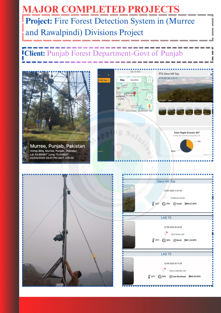
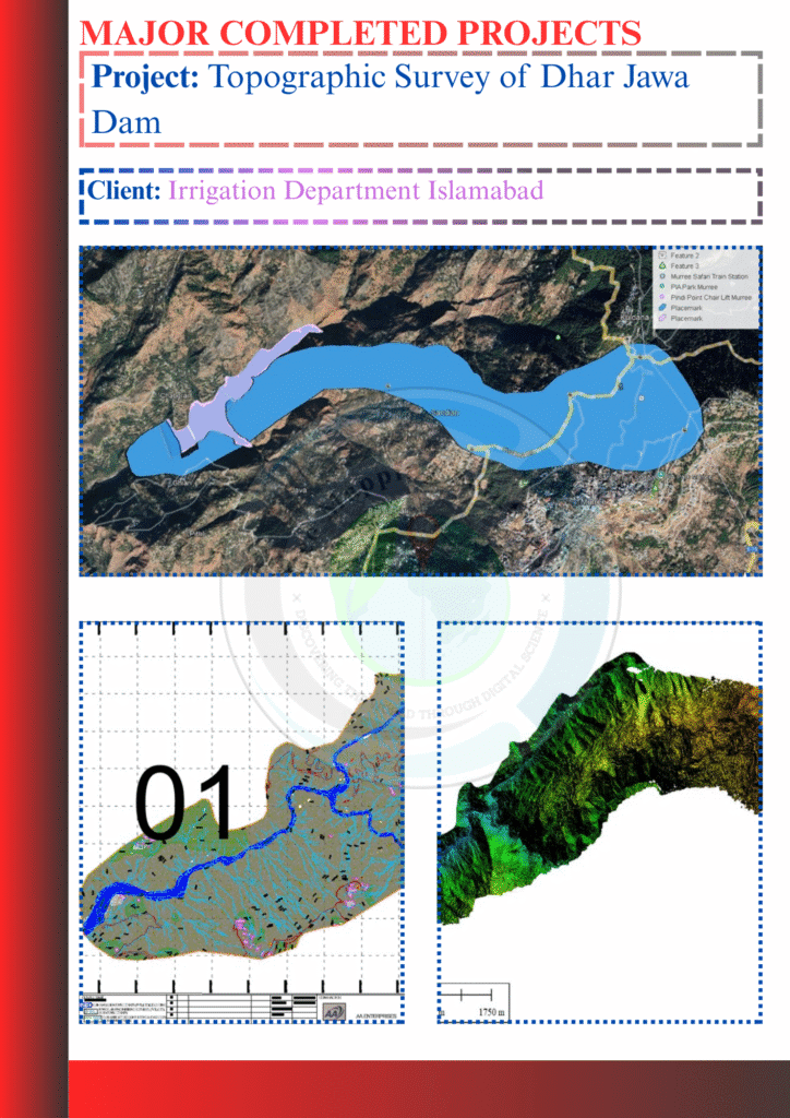
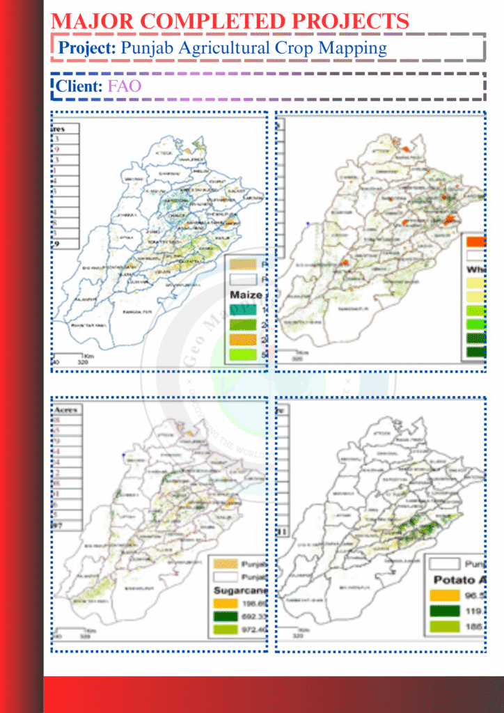
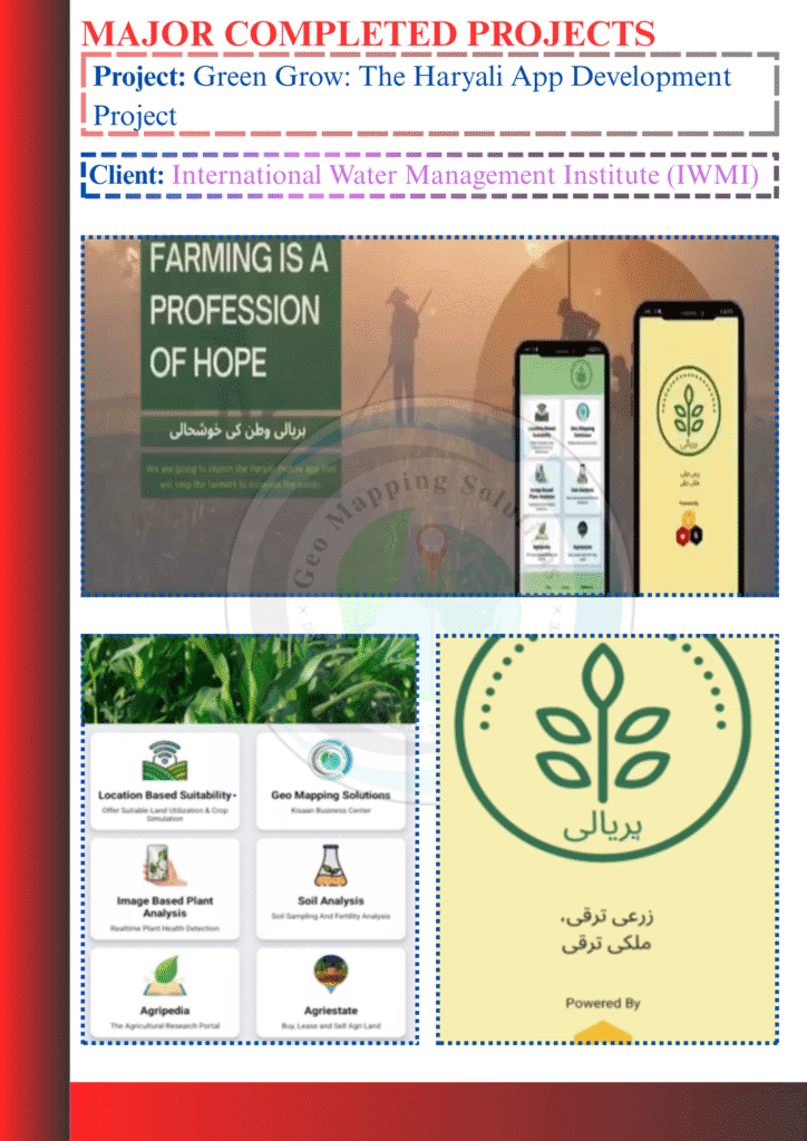
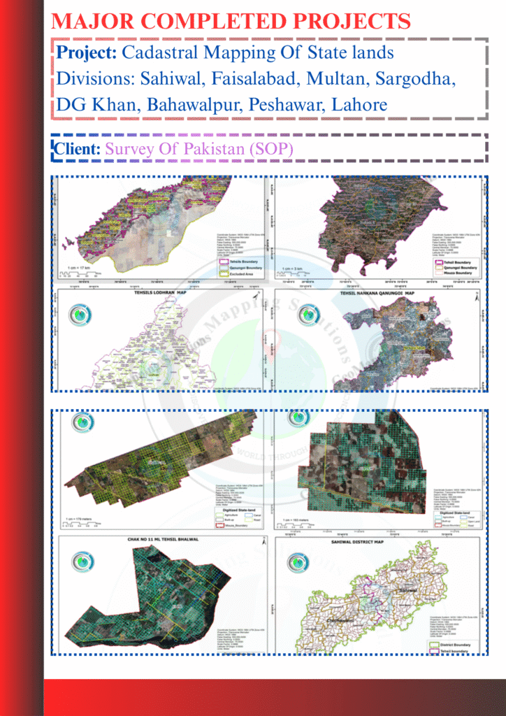
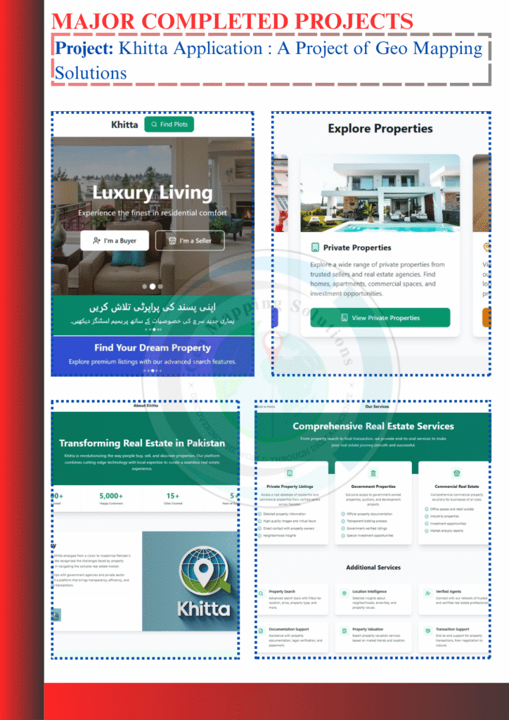
Here’s an overview of some of our recent project relating to various fields of Remote Sensing & GIS, including Cadastral mapping, soil and demographics mapping.

Aerial view of PMDC land with cadastral boundaries overlaid, processed by GeoMapping Solutions Pvt. Ltd.
Topographic survey map showing elevation contours and terrain features of Tamman Dam command area in Chakwal District, created by GeoMapping Solutions Pvt. Ltd.
Map interface showing real-time forest fire detection alerts in Murree and Rawalpindi division, developed by GeoMapping Solutions Pvt. Ltd.
Topographic map of Dhar Jawa Dam site showing elevation contours and terrain features, created by GeoMapping Solutions Pvt. Ltd.
Hyperspectral analysis map showing mineral distribution across selected sites in District Chaghi using EnMAP satellite data, processed by GeoMapping Solutions Pvt. Ltd.
Mineral mapping output using ASTER satellite data showing geological features in Yasin, Ishkoman, and Thatta tehsil blocks, processed with GIS and remote sensing by GeoMapping Solutions Pvt. Ltd.
Hyperspectral mineral mapping output of Tehsil Chilas using ZY1E satellite data, showing spectral anomalies and geological features processed by GeoMapping Solutions Pvt. Ltd.
Hyperspectral mineral distribution map of Tehsil Diamir derived from ZY1E satellite data using remote sensing and GIS techniques by GeoMapping Solutions Pvt. Ltd.
High-resolution ortho-rectified satellite image showing geospatial mapping of a reservoir using 15cm HD and 30cm stereo optical data, processed by GeoMapping Solutions Pvt. Ltd.
Software interface displaying newly acquired satellite imagery and geospatial tools purchased for non-development services by GeoMapping Solutions Pvt. Ltd.
Field staff using high-precision GPS tablet for geospatial data collection during a mapping project by GeoMapping Solutions Pvt. Ltd.
High-resolution satellite imagery displayed on geospatial software interface, used by GeoMapping Solutions Pvt. Ltd. for advanced analysis and mapping.
Interactive web-based dashboard displaying mapped water bodies across Pakistan, developed by GeoMapping Solutions Pvt. Ltd. for national water resource inventory.
Satellite-based remote sensing analysis for mineral exploration in Pakistan over 10,000 sq. km area for PMDC mineral blocks
Engineering Chakbandi Plan for Small Dams in Pothohar Zone, Rawalpindi/Islamabad
Land Use Land Cover (LULC) and cropping pattern assessment in Chakwal, Okara, and Rahim Yar Khan districts
Rainwater harvesting and storage mapping in the Pothohar region of Pakistan
Topographic drone survey of a 1.5 sq km site in Al Ula, Saudi Arabia for terrain and elevation mapping
Topographic survey data processing for Al Badaa Sludge Treatment Plant infrastructure planning
Topographic land survey of Aman Staff Village site in Al Ula, Saudi Arabia for site planning and development
Architectural drawings and project deliverables for Aman Hegra Residences in Al Ula, Saudi Arabia
Technical drawings and project deliverables for Delta B District development at Qiddiya, Saudi Arabia
Geodatabase development for Work Order SO-022 in NEOM for spatial data integration and infrastructure planning
Topographic survey of the command area for accurate terrain mapping and irrigation planning
Satellite-based agricultural crop mapping in Punjab for seasonal monitoring and land use analysis
Green Grow – Haryali mobile app for plantation tracking, environmental monitoring, and community engagement
Cadastral mapping of state-owned lands in Sahiwal, Faisalabad, Multan, Sargodha, DG Khan, Bahawalpur, Peshawar, and Lahore divisions
Khitta mobile application for land parcel mapping, geo-referencing, and property boundary digitization
Introduced GIS
0 +
Projects Done
0 +
Qualified Employees
0 +
Office Branches
2